Chaussée Brunehaut ("Via Belgica")
Q572218Chaussée Brunehaut: French name of the Roman road that connected Amiens, Bavay, Tongeren, and Cologne. In Germany, it is called Agrippa-Straße and sometimes, the quasi-Latin name Via Belgica is used.

When Julius Caesar arrived in northern Gaul in 57 BCE, there were already many ancient roads. One of these ran along the rivers Sambre and Meuse, and connected the territories of the Ambiani, Atrebates, Nervians, Atuatuci, and Eburones to the Rhine. Although the road had not been paved, its course can easily be reconstructed, because since time immemorial people were buried along it. If plotted on a map, Neolithic, Bronze Age, and Iron Age funerary monuments clearly show an almost straight line, which must indicate the course of the prehistoric route.
When Caesar advanced from the Atrebates against the Nervians, he used this road; his enemies could therefore easily decide where to attack the Romans, but were, in spite of their greater knowledge of the terrain, defeated at the river Sabis. Continuing along this route, Caesar reached the Atuatuci, and besieged one of their hill forts, which was situated a bit south of the main road. It has recently been proposed that the Fourteenth Legion was (in the winter of 54/53 BC) defeated by Ambiorix at Kanne-Caster, 4½ kilometers south of the place where the road crossed the Meuse, which here turns north.

Among the indications that the Romans merely paved -with small stones, not with big slabs- an already existing road is the fact that they continued to measure distances in leugae (units of 2,223 meters) instead of Roman miles. On the other hand, several towns along the road certainly owed their existence to the Romans, and can be dated to the first half of the reign of the emperor Augustus. Part of the evidence is archaeological; other towns are mentioned on the Peutinger Map, which is based on a world map created by Augustus' friend Agrippa, the founder of Cologne and builder of at least three other roads in Gaul (from Lyon to Bordeaux, to Boulogne, and to Cologne).
The following table mentions the towns on the map. The distances add up to 123 leugae or 273 kilometers for the route from Cambray to Cologne, which fits the real distances exceptionally well.
| Modern name | Peutinger Map | Evidence |
|---|---|---|
| Amiens | Samarobriva | Earliest finds 20-10 BCE |
| - | ||
| Cambray | Camaracum | |
| 11 leugae | ||
| Saulzoir | Hermomacum | |
| 8 leugae | ||
| Bavay | Bagacum | Earliest finds 20-15 BCE |
| 12 leugae | ||
| Givry | Vogdoriacum | |
| 16 leugae | ||
| Liberchies | Geminiacum | |
| 14 leugae | ||
| Perwez | Pernacum | |
| 16 leugae | ||
| Tongeren | Tongeren | Earliest finds 20 BCE |
| 16 leugae | ||
| Heerlen | Coriovallum | |
| 12 leugae | ||
| Jülich | Juliacum | Earliest finds neolithic |
| 18 leugae | ||
| Cologne | Ara Ubiorum | Founded 37 or 19 BCE |

Maastricht (Traiectum ad Mosam) can be added to this list. Although it is not mentioned on the Peutinger Map, the crossing of the Meuse must have been an important place. Again, the earliest finds belong to 30-20 BCE, and although the bridge has not yet been in vestigated dendrochronologically, it may well belong to the earliest monuments of this town - in fact, its raison d'être.
There were several other paved streets, and it is interesting to see that Bavay and Tongeren are both the node of several roads. Direct roads connected Bavay
- the east-northeast to Tongeren and Cologne (the so-called "Via Belgica"),
- to the east to Dinant,
- to the east-southeast to Trier,
- to the southeast to Reims,
- to Cambrai and Vermand in the southwest,
- to Arras in the west,
- to Blicquy in the northnorthwest,
- and to Tournai in the north.
This brings the grand total to eight Roman roads if we add the streets to Cambray and Amiens and to Tongeren and Cologne. Tongeren was a similar node, with roads to Cologne and Bavay, and also
- to Cuijk (Ceuclum) and Nijmegen in the north,
- unidentified places in the northwest,
- Tienen in the west,
- Amay, Arlon (Orolaunum), and Metz (Divodurum) in the south
- Liège (Leodium) and Trier in the southeast.
One gets the impression of a grand design that consisted of two central nodes, created to develop the valleys of the Sambre and Middle Meuse. Presented like this, the impression is probably wrong, because there is no proof that all these roads were created at the same time. On the other hand, it is reasonably certain that Bavay and Tongeren were from the very beginning central nodes, both being connected to cities in the west and east, and to Reims in the south.
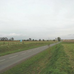
 The Chaussée Brunehaut between Cambray and Saulzoir |
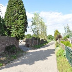
 The Chaussée Brunehaut south of Herderen |
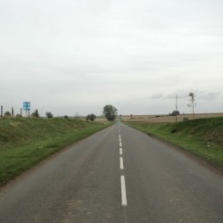
 The Chaussée Brunehaut between Saulzoir and Bavay |
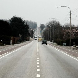
 The Chaussée Brunehaut between Tongeren and Maastricht |
The road from Amiens to Cologne - an almost straight line through the region - was of great strategic importance, because the Roman army in Germania Inferior could not be supplied from the Rhineland. The rivers Sambre and Meuse were used to transport wheat and barley, but land transport was always necessary, especially from Maastricht to Cologne.(An interesting inscription illustrating this trade was found in Nijmegen, and mentions a Nervian named Marcus Liberius Victor.)

It comes as no surprise that archaeologists have found many villas along the road (e.g., Voerendaal). Every measure was taken to make traffic as easy as possible: Heerlen boasted a large bathhouse and Taviers must have had a large inn, as the name its derived from Taberna.
It was not only Julius Caesar who used this street. During the final months of the Batavian Revolt (71), the Fourteenth Legion Gemina was summoned from Britain, and used this road. Two centuries later, the emperors of the Gallic Empire protected the road with all kinds of fortifications, essentially creating a half-protected zone between the Rhine and this road. This zone, which was poor, was soon occupied by Franks, who took their language with them; south of the road, on the fertile löss soils, Latin remained in use - the origin of the Language Border that still divides the Low Countries.

In the Middle Ages, the roads beginning in Bavay and Tongeren were called Chaussée Brunehaut ("road of Brunhilda"), a name that is still officially used and can be found in many municipalities in northern France and southern Belgium. This Brunhilda was a Visigothic princess who became queen of the Frankish kingdom of Austrasia, and was one of the most powerful rulers of the late sixth and early seventh century. She became the heroine of many sagas, such as the Nibelungenlied, and it is now difficult to see behind the legend and find out whether she really had something to do with the streets now named after her.
Still, it is possible - perhaps even likely - that the Merovingian kings and queens repaired the roads. It is due to these maintenance efforts of later rulers that the road is still recognizable on many places and is usually still in use. It has been listed by UNESCO as World Heritage.

The name Via Belgica is a recent invention by archaeologists, and is best avoided. The Romans named their roads after the men who built them: Via Appia, Via Egnatia, or Strata Diocletiana. It is only rarely that roads have a geographic element in their names, and in these cases, it invariably indicates a destination, not the country it traversed (Via Labicana, Via Portuense). Via Belgica would therefore be the name of the road leading to Belgica and can never have been an indication for a road through Belgica.
Literature
- P. Stuart, Langs de weg. De Romeinse weg van Boulogne-sur-Mer naar Keulen, verkeersader voor industrie en handel (1987)
- s.a., Erlebnisraum Römerstraße - Via Belgica (2008 Aachen)