Ağri Daği (the so-called Ararat)
Q72303Ağrı Dağı: volcano in eastern Turkey that is commonly but incorrectly known as Ararat. The Turkish name means "mountain of pain" and is a rendering of Çiyaye Agiri, which in Kurdish means "the fiery mountain". In Armenian, it is called Masis.
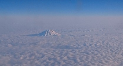
Ağrı Dağı, to use a name that does not create a famous misunderstanding, is a stratovolcano, which means that it is essentially an isolated cone that was built by the eruption of lava, ashes, and pyroclastic flows. As a consequence, it becomes very steep when one approaches the summit, which rises more than 3½ km above the plain and reaches a total height of about 5123 m. The violent way in which it was formed, explains why Ağrı Dağı looks so much like other stratovolcanoes (e.g., Etna and Vesuvius).
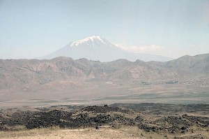
"Isolated", though, the conic mountain is only because there are no other summits in the direct neighborhood. At some distance, however, one can find the Little Ağrı Dağı, and several other volcanoes. The photo to the right shows the Ağrı Dağı in the distance, and in the foreground a nineteenth-century flow of volcanic, molten stones, which are from another volcano called Tendürek.
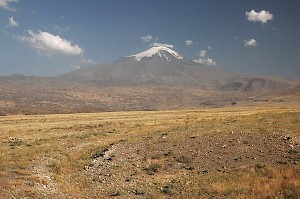
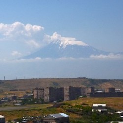
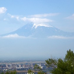
Still, the snow-capped Ararat is the largest and most impressive of all summits in eastern Turkey, and was the center of the ancient kingdoms of Urartu and Armenia, which are essentially the valley of the river Araxes (north of the mountain) and the area surrounding Lake Van (south of the mountain). The Armenians called the mountain Masis and held it in great esteem. For example, the southern gate of the Urartian town of Teishebani (Karmir Blur in modern Yerevan) was directed at the snow-clad peak.
Impressive as it is, it was only logical that Ağrı Dağı became to be identified in the Middle Ages with the mountain mentioned in the Bible as the site of Noah's disembarking after the Great Flood, the Ararat.note This identification, which can be found in the History of Armenia by Moses of Chorene and may have started among Armenian Jews or Christians, is incorrect. The Bible does not refer to a summit called Ararat, but to "the mountains of Ararat", and this proper name refers to the kingdom of Urartu.note
Ancient Jewish authors and early translators of the Bible were well aware that there was no mountain called Ararat. The author of the second-century BCE Book of Jubilees states that the Ark landed on "Mount Lubar" in "the land of Ararat",note and the Jewish historian Flavius Josephus knew that "Ararat" referred to a summit south of Lake Van. He also records a tradition that identified Noah's landing site with Mount Baris in a country north of the Tigris called Gordyene.note Josephus adds that in his days, bitumen could still be found near the site of the Ark.
Babylonian sources concur. In his account of the Flood, Berossus also refers to the presence of bitumen near the place where the Ark landed, the Epic of Gilgameš (text) also refers to mountains in what is now Kurdistan, and the Quran speaks of Al-Gudi (text). In sum: the author of Jubilees, Flavius Josephus, the Babylonian writers, and the Quran have retained an older tradition, which puts the Ark's landing site between Lake Van and the Tigris.
This must be the site which the ancients believed was the location of the final act of the story of the Flood, where the hero disembarked and sacrificed. It may perhaps be identified with a summit to the northeast of modern Cizre called Cudi Dağı, where Jews, Musulims, and eastern Christians - unaware of the identification of Ararat with Ağrı Dağı - still identify the tomb of Noah/Nuh. The Armenians, up til the present day, hold the Masis/Ağrı Dağı in high esteem and continue to call it Ararat.
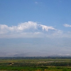 Ararat from Artaxata |
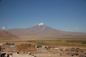
 Ağri Daği, Summit |
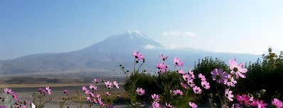
 Ararat from Erebuni |
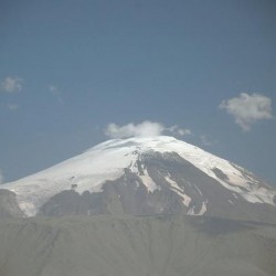
 Ararat from Yerevan |